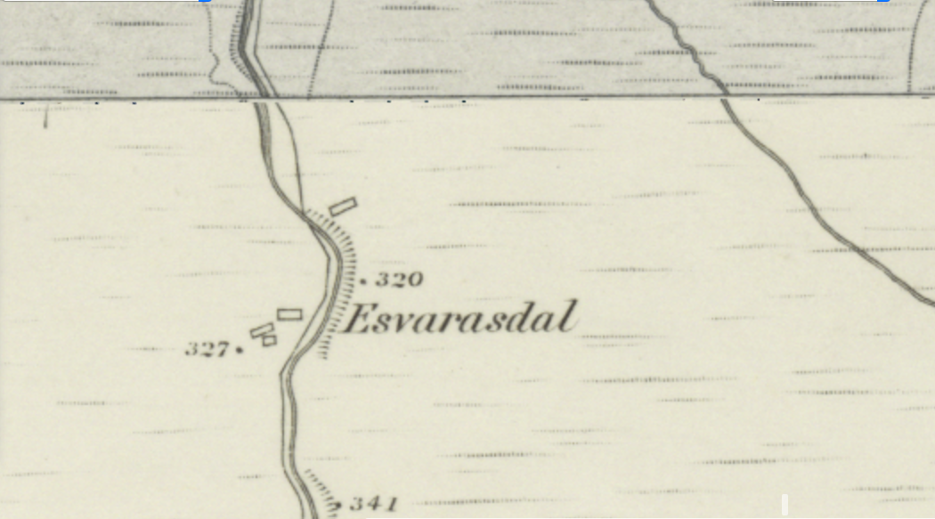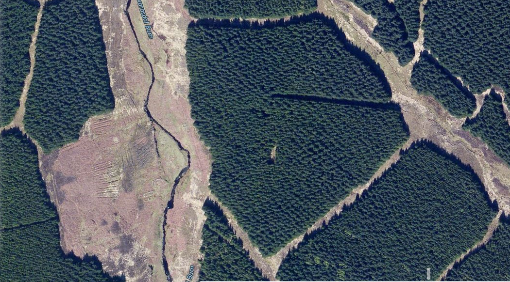


My 3rd x great grandfather and his brother were born at a place called Esvarasdal, Caithness, Scotland in the late 1700’s. This place is not marked on any modern day maps, but I did manage to find an old map on the brilliant National Library of Scotland website http://maps.nls.uk/geo/explore/#zoom=17&lat=58.5161&lon=-3.7253&layers=5&b=1 which showed a small settlement of 3 dwellings. This website enabled me to overlay the co-ordinates onto a current image of the area. In among the spruce plantations, the foundations of those dwellings can be seen today! An archaeological dig conducted in1985, suggests the buildings were probably a farmhouse, landing place, cairn and farm. Astounding to imagine that this is the very place where my ancestors lived 250 years ago! © Speak of the Past 2018.